Once you receive your flight link, you’ll be able to view your flight data through Drone Deploy’s convenient web viewer. This gives you access to the orthomosaic image, plant health, elevation model, and 3D model of the site. It also features five different analysis tools.
Orthomosaic
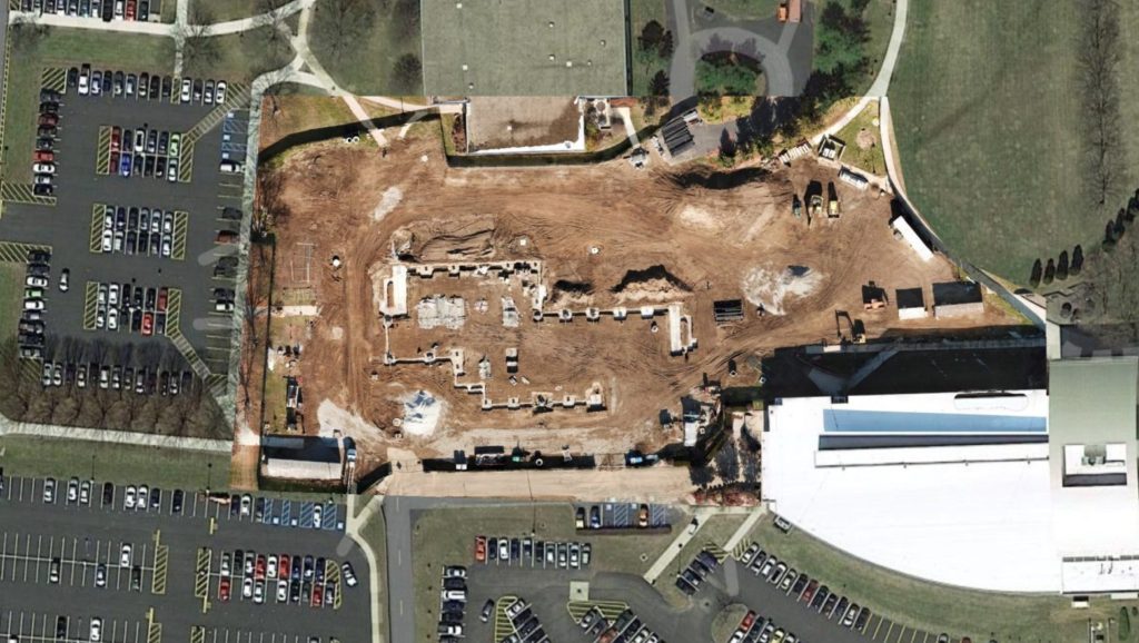
The 2D orthomosaic is the single image that has been stitched together from all of the other images. These are best generated with a map flight. These images can be exported (GeoTIFF, JPG, PDF), stored locally and used in a variety of ways within your organization.
Site progress
Contract enforcement/dispute resolution
Safety reviews
CAD overlays
Insurance claims
Property conditions
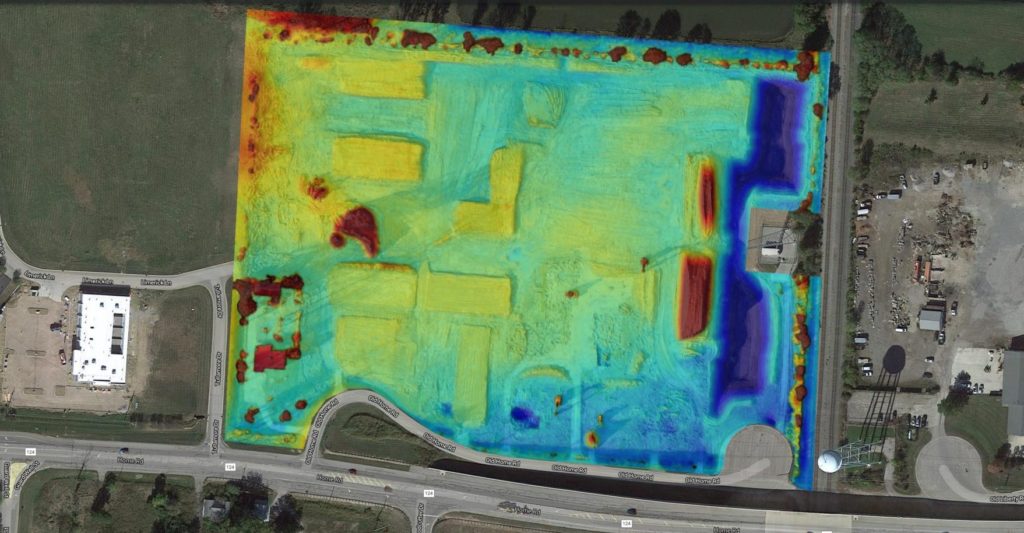
Elevation
Elevation data for the site can be seen by clicking the box next to “Elevation” in the panel on the left. This data is reasonably accurate with sufficient image coverage of the site. Higher accuracy elevation data can be obtained but is not a service we offer at this time. Export file types for this data are GeoTIFF, JPG, and PDF. It is also possible to export DXF contour files with intervals down to 1 foot and the data can be aligned to various geodetic coordinate systems (ground control points required).
Use in quoting or bidding process
Analyze water run-off
Verify site work
Floodplain data (Insurance)
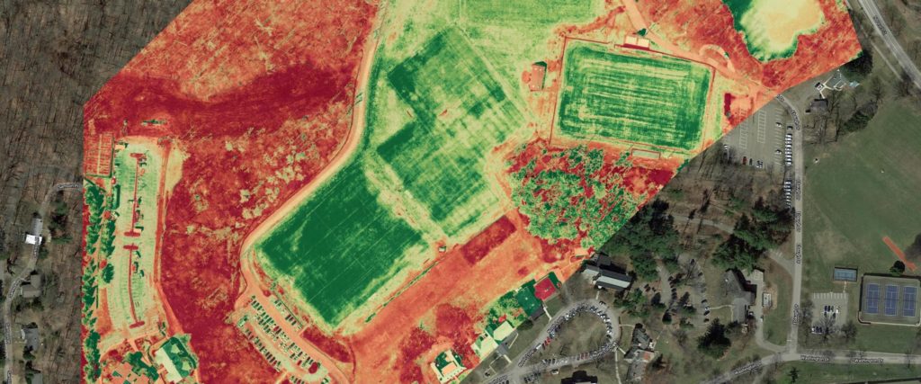
Plant health
If you want to make sure your crops are healthy during the grow season, or you manage properties and want to ensure the beauty of your green spaces, you’ll appreciate the plant health feature. The software can measure “how green” the plants are from the drone imagery. Monitoring crops once a month during the grow season could ensure a larger yield. Monitoring green spaces throughout your property portfolio could save you money in grounds maintenance.
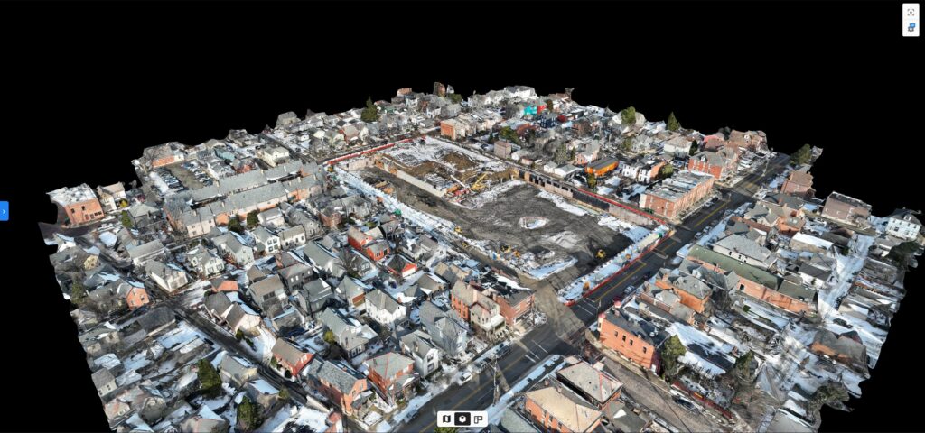
3D Model
By clicking the “Model” button on the panel, you can view a 3D model of your property or job site. This is a useful tool for viewing site progress or property conditions with remote management teams. A model is always automatically generated with each flight but higher quality models require oblique imagery (model flight).